Monterey Bay Coastal Recreation Trail
About
The Monterey Bay Coastal Recreation Trail is an asphalt path that starts in Castroville and runs about 18 miles to Pacific Grove. TrailLink puts it closer to 19 miles and gives the Castroville start at Haro Street. It's rated easy, open in all seasons and free to use.
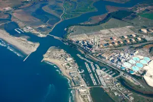
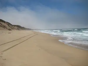
Much of the route follows the old Southern Pacific Railroad line that once linked Castroville to Fisherman's Wharf and Cannery Row. The trail was created in 1986 by the Monterey Peninsula Regional Park District, the Coastal Conservancy and the cities of Pacific Grove, Monterey and Seaside. Along the way it passes Marina State Beach, Fort Ord Dunes State Park, Cannery Row, the Monterey Bay Aquarium and Lovers Point.
The Castroville end is a paved bike path that runs beside the highway past artichoke fields. The Moss Landing section has been a gap, and a planned path and bridge there were not confirmed as finished, so check before riding north. Walkers, joggers and cyclists all use it, the total climb is only about 320 feet, and rentals for bikes, kayaks and paddleboards turn up along the route.
How we score it 4.2
How we rate placesOur editors' score out of 5, the weighted average of the parts above. Visitor reviews are shown separately and never change it.
Reviews
No reviews yet. Be the first to say what it's like.
Been here? Write a reviewRate it and tell other visitors what it's like.
You can write your review now. When you post it, we'll ask you to log in or sign up, and your review will be waiting when you come back.