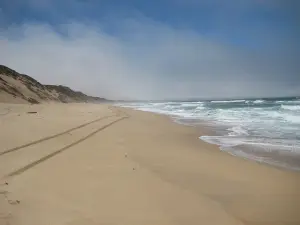
Fort Ord National Monument
Photo: blmcalifornia, Public domain, via Wikimedia Commons
About
Fort Ord National Monument covers 14,651 acres along Monterey Bay north of Monterey, with one entrance at the end of Gigling Road in Seaside. It was established on April 20, 2012 by presidential proclamation. The Bureau of Land Management runs it as part of the National Conservation Lands.
The land was used for artillery training from 1917, became Camp Ord in 1933 and Fort Ord in 1940, and the Army closed the post in 1994. Today more than 91 miles of trails serve hikers, cyclists and riders. It's home to the endangered Smith's blue butterfly and Contra Costa goldfields, the threatened California tiger salamander and old coast live oaks.
Some trails are fenced off because of possible unexploded ordnance, so stay on open routes. Hours, parking and fees weren't on the page we used, so check blm.gov before you go. A 13-mile trail linking the monument, the Salinas River and Fort Ord Dunes State Park is planned.
How we score it 4.1
How we rate placesOur editors' score out of 5, the weighted average of the parts above. Visitor reviews are shown separately and never change it.
Reviews
No reviews yet. Be the first to say what it's like.
Been here? Write a reviewRate it and tell other visitors what it's like.
You can write your review now. When you post it, we'll ask you to log in or sign up, and your review will be waiting when you come back.